
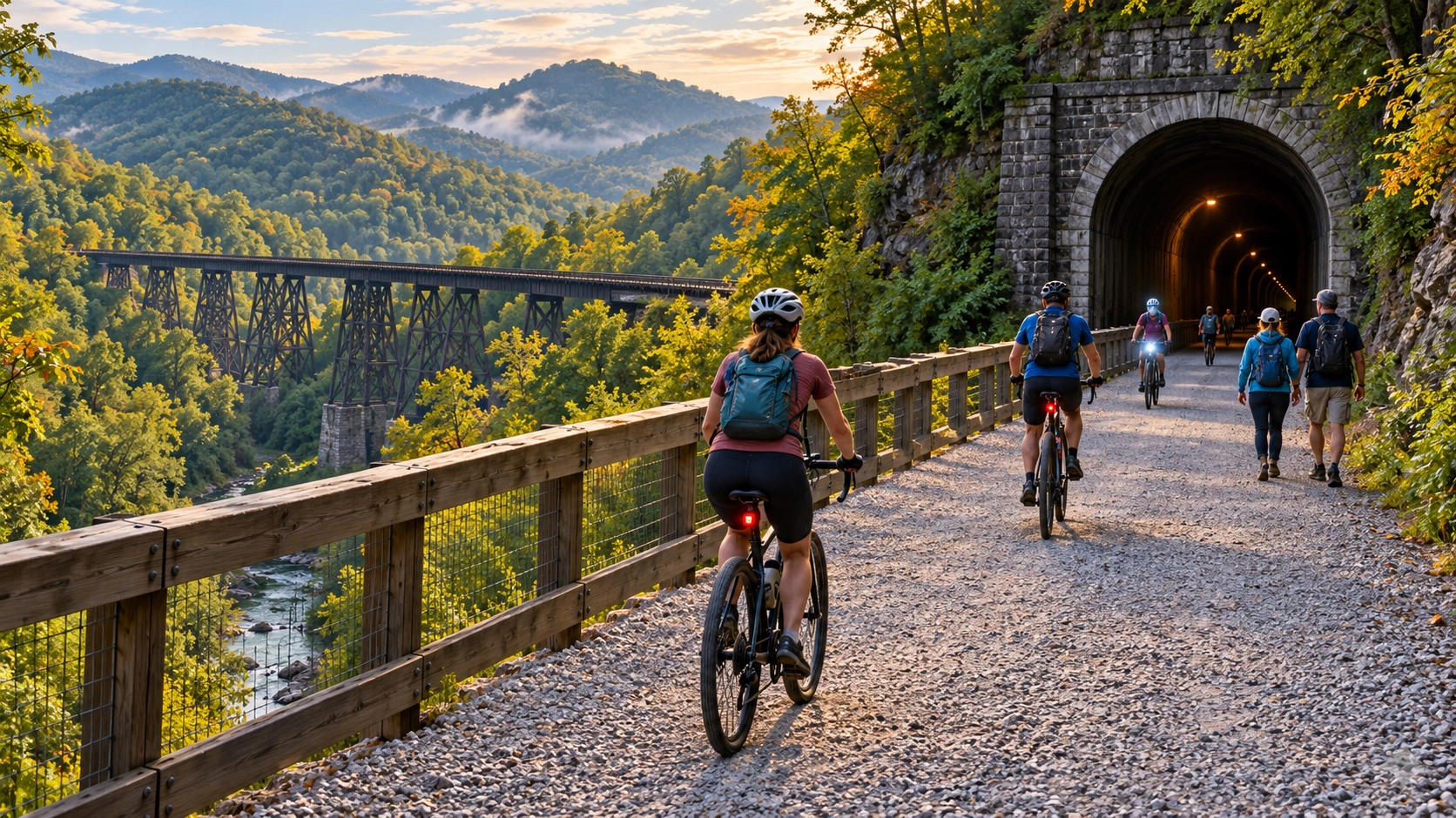
The Dawkins Line Rail Trail is a 36-mile hiking, cycling, and horseback-riding route in eastern Kentucky. It follows a former rail corridor from Hagerhill to Evanston and crosses trestles, wooded cuts, and mountain communities. It is also a trail where current access information matters: Kentucky State Parks presently warns visitors to avoid the Breathitt County section because of rough spots between the Jane Beshear Trailhead and Tip Top.
Do not plan an end-to-end trip from an old map. Check the official Dawkins Line page immediately before traveling and choose a segment that is currently recommended.
Current planning facts
- Total corridor: 36 miles from Hagerhill to Evanston.
- Uses: Hiking, bicycling, and horseback riding.
- Hours: Sunrise to sunset.
- Motorized vehicles: Not allowed.
- Pets: Must be leashed.
- Critical alert: Avoid the Breathitt County portion while the state warning remains posted.
Tunnels and trestles
Kentucky State Parks says the first 25 miles to Tip Top include 24 trestles and the 662-foot Gun Creek Tunnel. Carry a light for the tunnel and use it before entering; a bicycle headlight is better than relying only on a phone.
The final 11 miles of the corridor have been completed, but the Tip Top Tunnel is not open. The Evanston side is therefore accessible only from Breathitt County. That break is important for anyone considering a through-ride, shuttle, or long-distance itinerary.
Official trailheads
These coordinates are published by Kentucky State Parks. Save the chosen point before leaving home and verify the recommended road approach:
- Jenny’s Creek: 37.78490, -82.83633
- Swamp Branch: 37.73781, -82.90660
- Royalton: 37.67620, -83.02173
- Jane Beshear: 37.68063, -83.03163
Because the current warning concerns the section from Jane Beshear toward Tip Top, do not select that area without first confirming the alert has been lifted. A trailhead being marked on a map does not guarantee that the adjoining segment is suitable that day.
Choose a realistic distance
An out-and-back ride doubles every mile traveled away from the car. A five-mile ride out becomes ten miles total. Set a turnaround time based on daylight, weather, fitness, and the slowest person in the group. Long sections can have limited services, so do not count on finding water or food beside the trail.
For a first visit, a shorter out-and-back from a currently recommended trailhead is more practical than attempting the full corridor. Riders planning a one-way segment need a confirmed shuttle and should not assume mobile service will be reliable.
Surface, weather, and equipment
Rail trails are usually gentler than mountain singletrack, but rough spots, washouts, debris, trestles, and tunnel darkness still require attention. Conditions can change after storms. Kentucky State Parks strongly recommends helmets; wear one on every bicycle ride.
Bring water, food, a basic repair kit, a light, identification, and a downloaded map. Tell someone your route and expected return. The state advises visitors not to go alone. Horse users should confirm trailer parking and current segment suitability before hauling to the trail.
Trail etiquette and neighboring property
Stay on the designated trail and respect private land along the corridor. Slow down when passing walkers or horses, announce your approach, and yield with enough space for animals to remain calm. Keep pets leashed and remove litter. Motorized vehicles are prohibited.
A safe pre-trip checklist
- Read the state park alert on the morning of the trip.
- Confirm the chosen trailhead and approach road.
- Calculate the full out-and-back distance.
- Download a map and share the plan with someone off-trail.
- Pack water, a light, weather layers, and repair supplies.
- Turn around early enough to finish before sunset.
Official source
Kentucky State Parks: Dawkins Line Rail Trail, alerts, rules, and trailheads


